By Chakyra Butler, Staff Writer
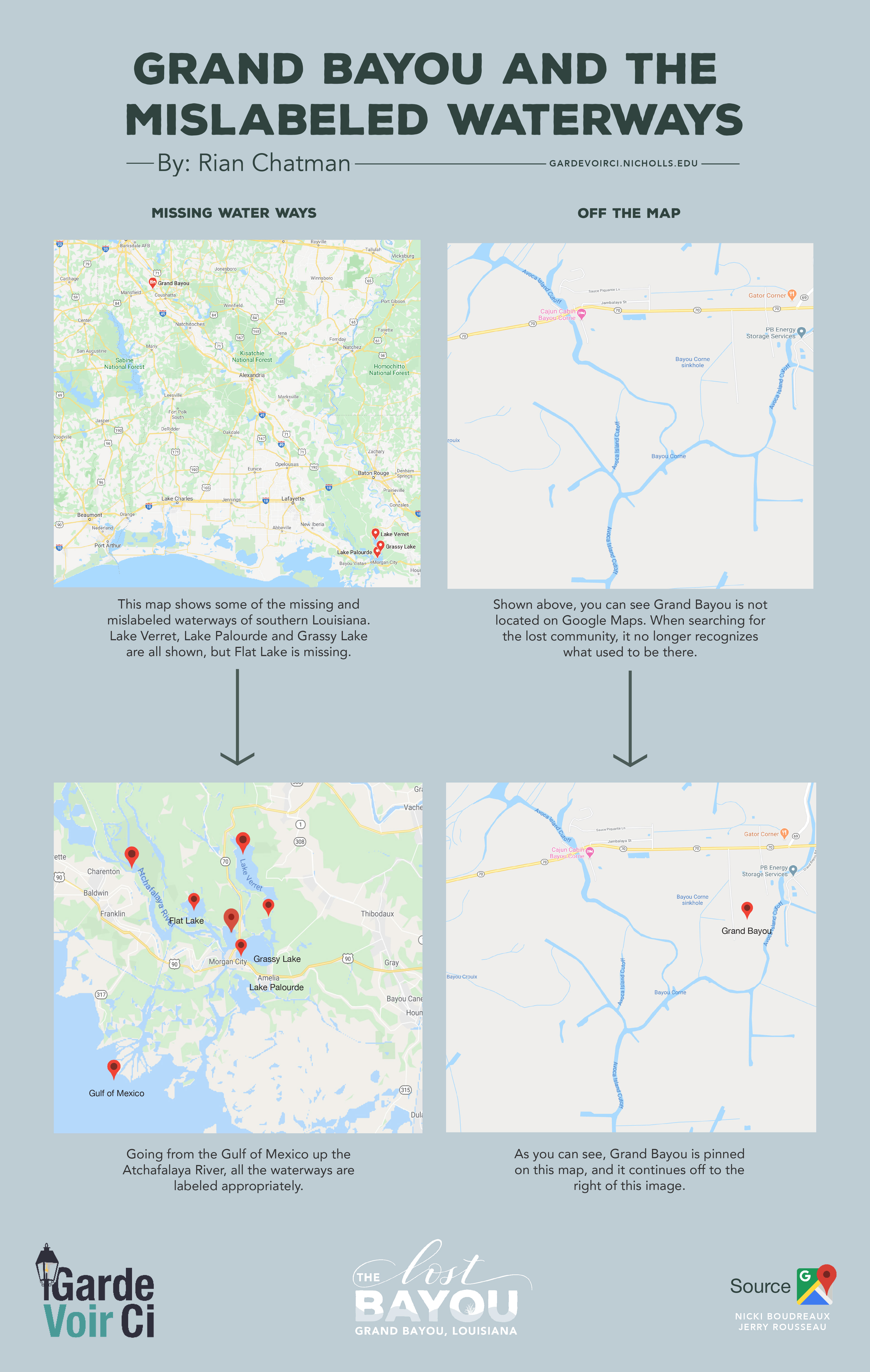
With only a few abandoned buildings left in Grand Bayou, it can be a difficult place to find. An internet search for Grand Bayou, Louisiana, pulls up a community in North Louisiana near Shreveport. And when the area is finally found on a map, Google Maps has mislabeled the area’s waterways — once the center of the vibrant community.
Online, the waterway along Highway 69, near Highway 70, is labeled as Avoca Island Cutoff. That bayou, along with many other surrounding waterways, are all mislabeled with that same name. Some former residents of Grand Bayou were not even aware of the bayou being incorrectly named.
“I don’t know why it’s like that,” says Nicki Boudreaux, whose maternal family is from Grand Bayou. “We talked about calling Google and having them fix it.”
Former resident Jerry Rousseau says he did not know Grand Bayou was mislabeled until it was recently brought to his attention. He said the bayou and the canals go to Lake Verret, not the cutoff.
“So, Avoca Island is definitely not right there,” Rousseau says. “It’s just mislabeled.”
Rousseau says his property, the Hebert property, in Bayou Corne is mislabeled at Assumption Parish Assessor’s Office.
The real Avoca Island is located south of Morgan City and off the Intracoastal Waterway in the Morgan City bayous. It’s bay, Avoca Island Cutoff, is more than 40 miles away from Grand Bayou.